Links

OGC Code Sprint

Excited to be participating in the Joint OGC (Open Geospatial Consortium), OSGeo (Open Source Geospatial Foundation), ASF (Apache Software Foundation) Code Sprint 2021, Feb. 17–19! There’s a pre-event webinar on the 12th, so get registered soon.

National Park Typeface

The Design Outside (DO) Studio Presents “National Park,” a typeface designed to mimic the National Park Service signs that are carved using a router bit.

Oh, for a reason to use this new National Park typeface!

Norway, Mother of All Flags

The flag of Norway, with boxes denoting the flags of other countries whose designs can be found within the flag.

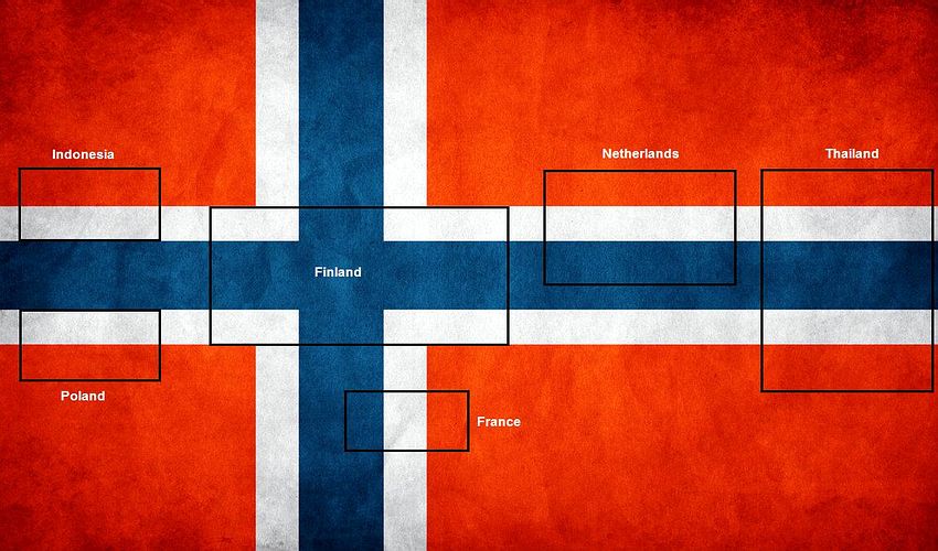
Look at how many other flags can be found within the flag of Norway! The Nordic Cross and common red, white, and blue surely contribute: Alex Crouch at the Flag Institute has the details.

Topographic Diversity

Map by Joshua Stevens of topographic diversity in the contiguous United States.

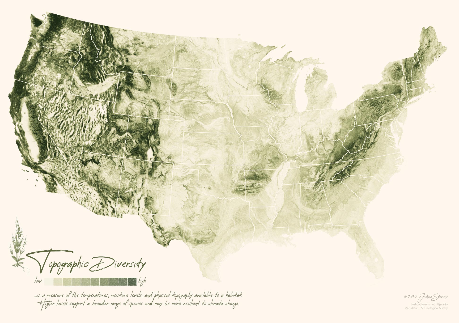
Oh my goodness, this is gorgeous! Joshua Stevens created this striking map with USGS data on topographic diversity, which is comprised of a number of types of data, not just elevation.

Amtrak System Map

Amtrak System Map

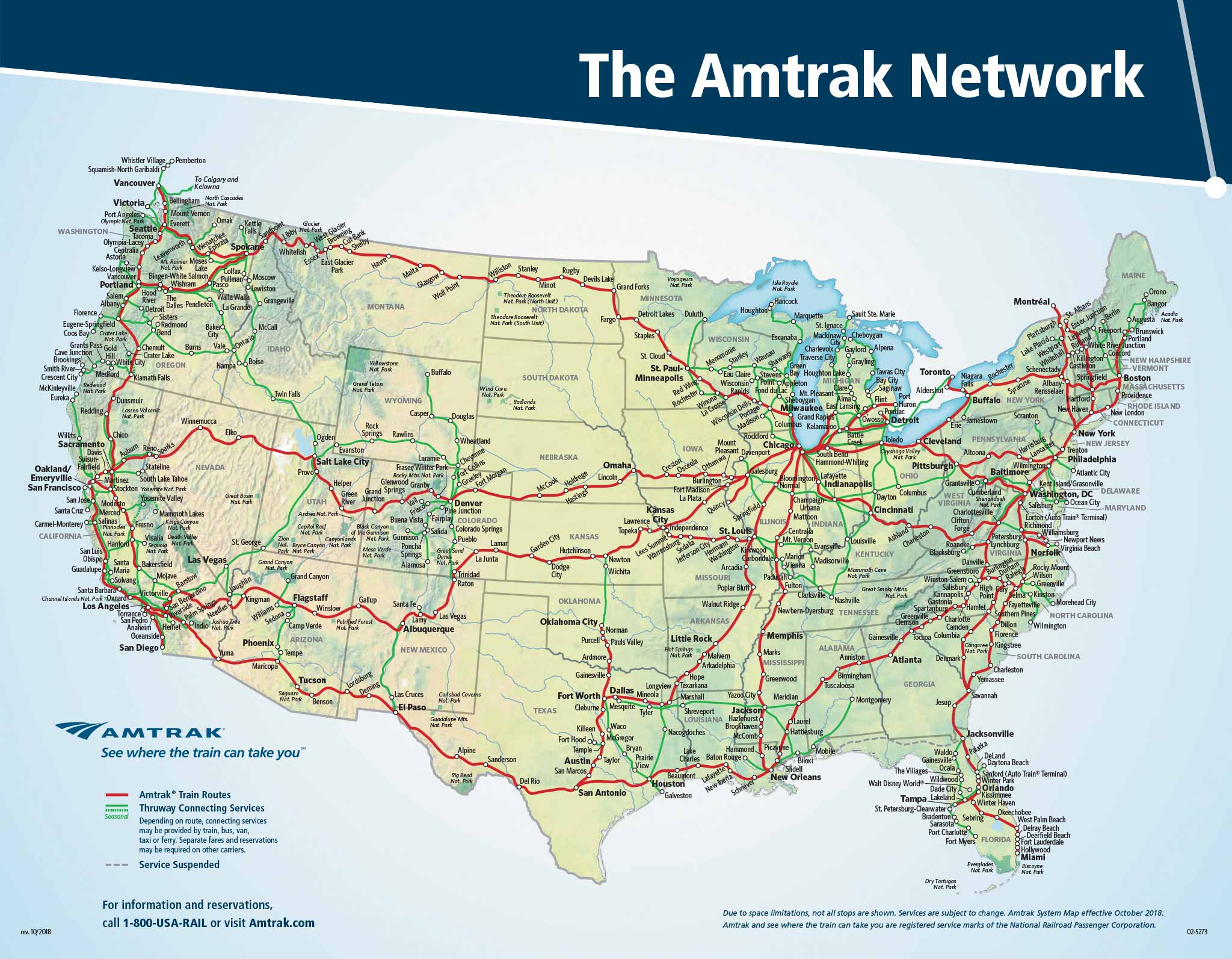
Took my son to the American Natural History Museum in New York for his sixth birthday last week, and we spent more than half the ride from Lancaster, PA to Manhattan staring at the Amtrak National Route Map, dreaming of places to go and we’d get there. Needless to say, it was a wonderful ride and some great father-son time!

Peering Through the Trees

LIDAR image of a portion of Bainbridge Island

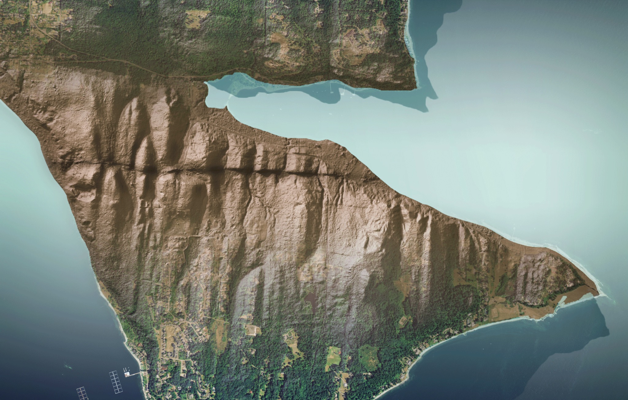
Incredible examples of LIDAR exposing geology otherwise hidden by foliage from the Washington State Geological Survey! Above is a fault scarp on Bainbridge Island.

seen at kottke.org