Magnolias, First Draft
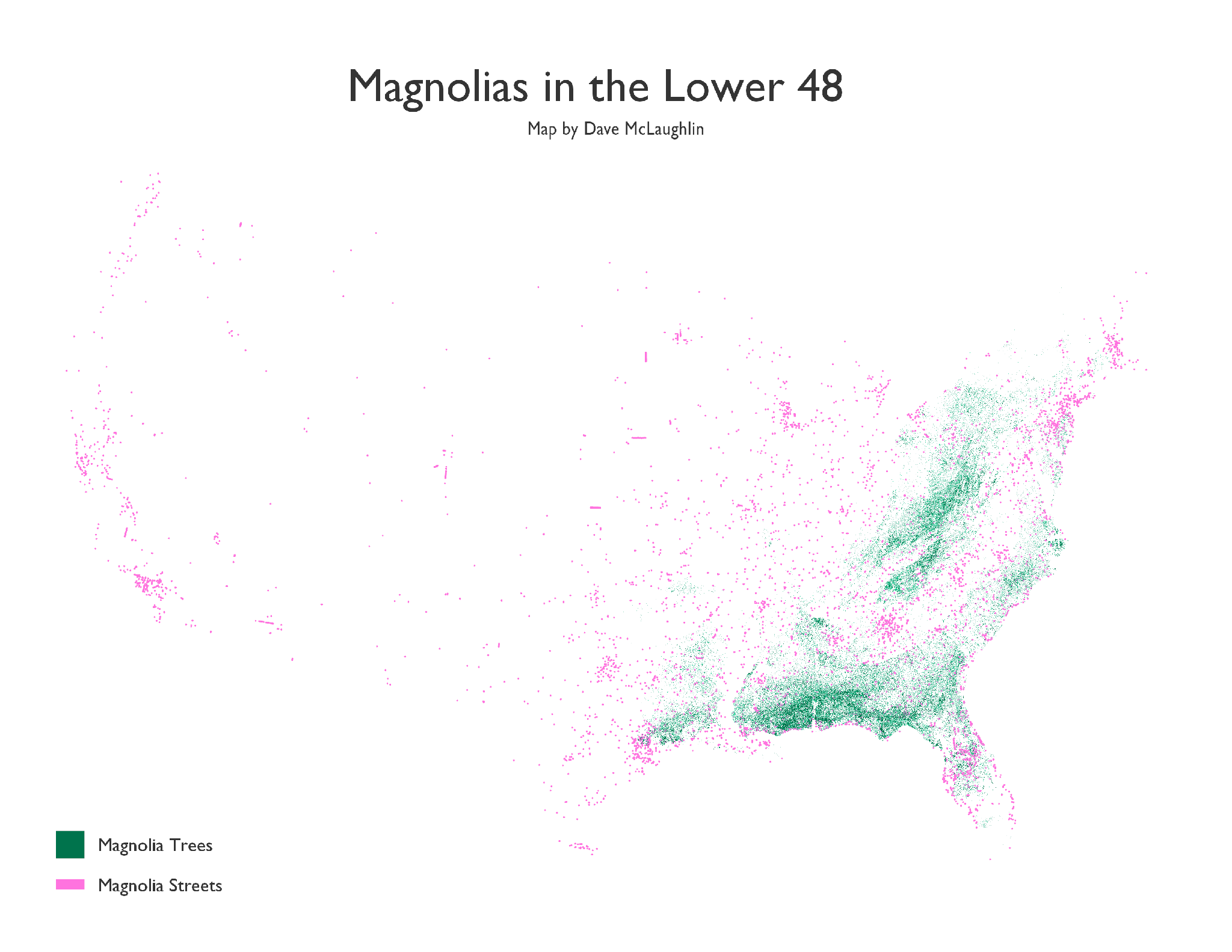
This is a rough first draft of a map showing where the US Forest Service says the various types of magnolia trees are in the US (green), along with all the streets with “Magnolia” in their name (pink), according to TIGER/Line roads data. This excludes all the “Magnolia Streets” in Puerto Rico, Hawaii, and Alaska(!), thousands of miles from the nearest (native) magnolia tree.
I’ve always loved literal road names! I live a mile or so from a White Church Rd, which is a country dirt road with a pretty little 1700’s church at the end of it…that is white. I love that! Of course things change over time. Sometimes the places change and the name no longer fits, even though it remains. Sometimes the name changes.
I saw some gorgeous tree distribution maps by Bill Rankin – they would count as inspiration, and his notes there also pointed me to the Forest Service data.
After finding my way back to Ben Fry’s All Streets map, and the musing he posted about wanting to compare street names to tree distributions since so many streets are named after trees, I was off to try to make something. He mentioned magnolias, so I started there.
I’ve thought for a while that I’d like to try to create some maps showing places (streets, towns, counties, etc.) that are named after species (plant or animal) that no longer reside there, due to habitat loss, extinction, climate change, etc. Maybe I’ll get there someday!
First priority for this map is dissolving the tree data a bit and working to make things more legible at normal sizes.