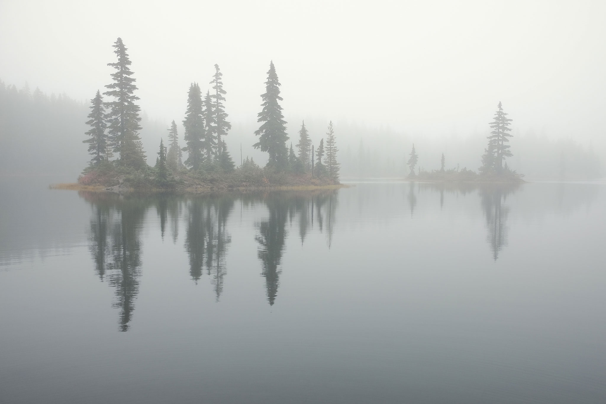
A companion photo to Forbidden Lake, this has been my desktop background for a year. Taken during one of the most magical moments I experienced on Vancouver Island last fall, this was from a slightly different vantage point along the lake in the Forbidden Plateau area of Strathcona Provincial Park.
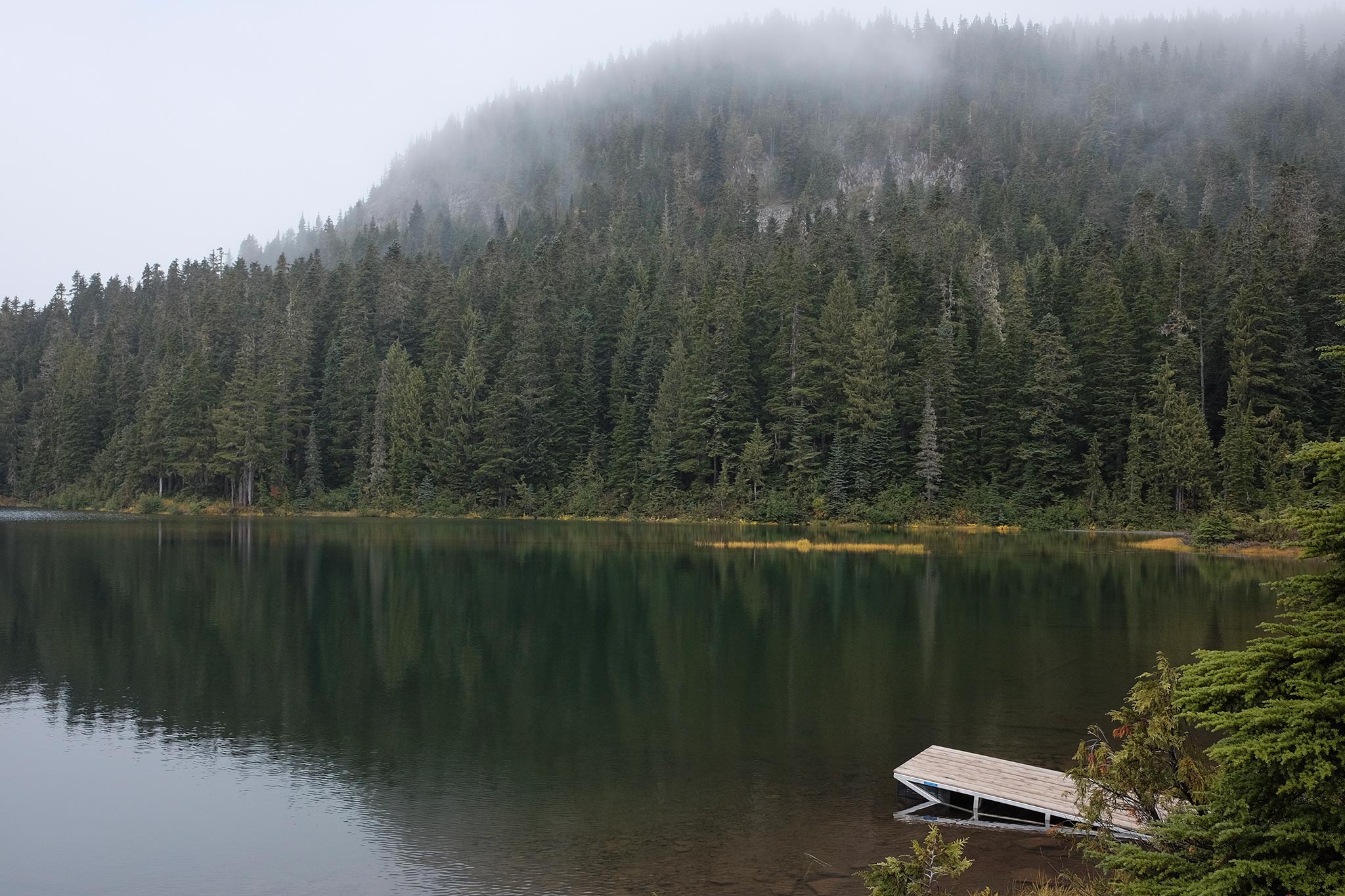
Hiking through the mist on the Forbidden Plateau in Strathcona Provincial Park, British Columbia, we came out of the forest to look over this small lake. Though this landscape may be a day’s hike from the nearest road, the sole human-made object in the photo, the dock, shifts our view of the lake, forest, and mountain such that we encounter them together as a source of recreation.
Taken with my little Fuji X70 and those beautiful Fuji jpeg colors. (Straight out of the camera plus a little straightening.)
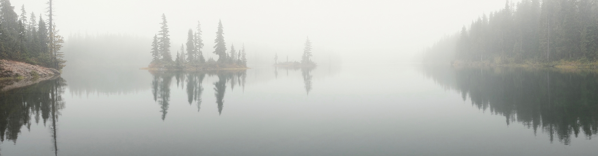
Speaking of Vancouver Island and Strathcona Provincial Park, here’s a photo from a foggy hike around the Forbidden Plateau. Surreal, magical, etc. I can still feel the mist six months later.
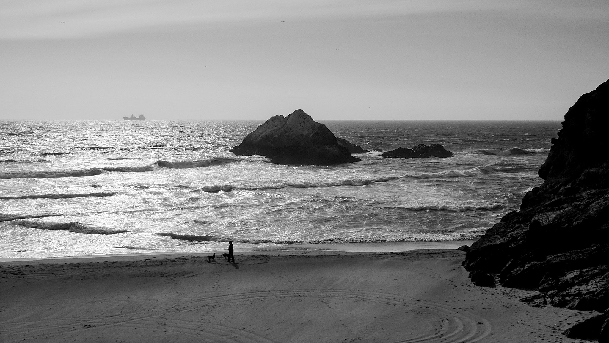
At the edge of the landscape, overlooking a San Francisco beach and Seal Rocks next to the Cliff House, with the ocean stretching beyond the horizon, we feel boundless and bounded at the same time. The ship can come no closer, the person and dogs can go no further, and the truck has had to turn around. The water occupies the same space, yet never stops moving.
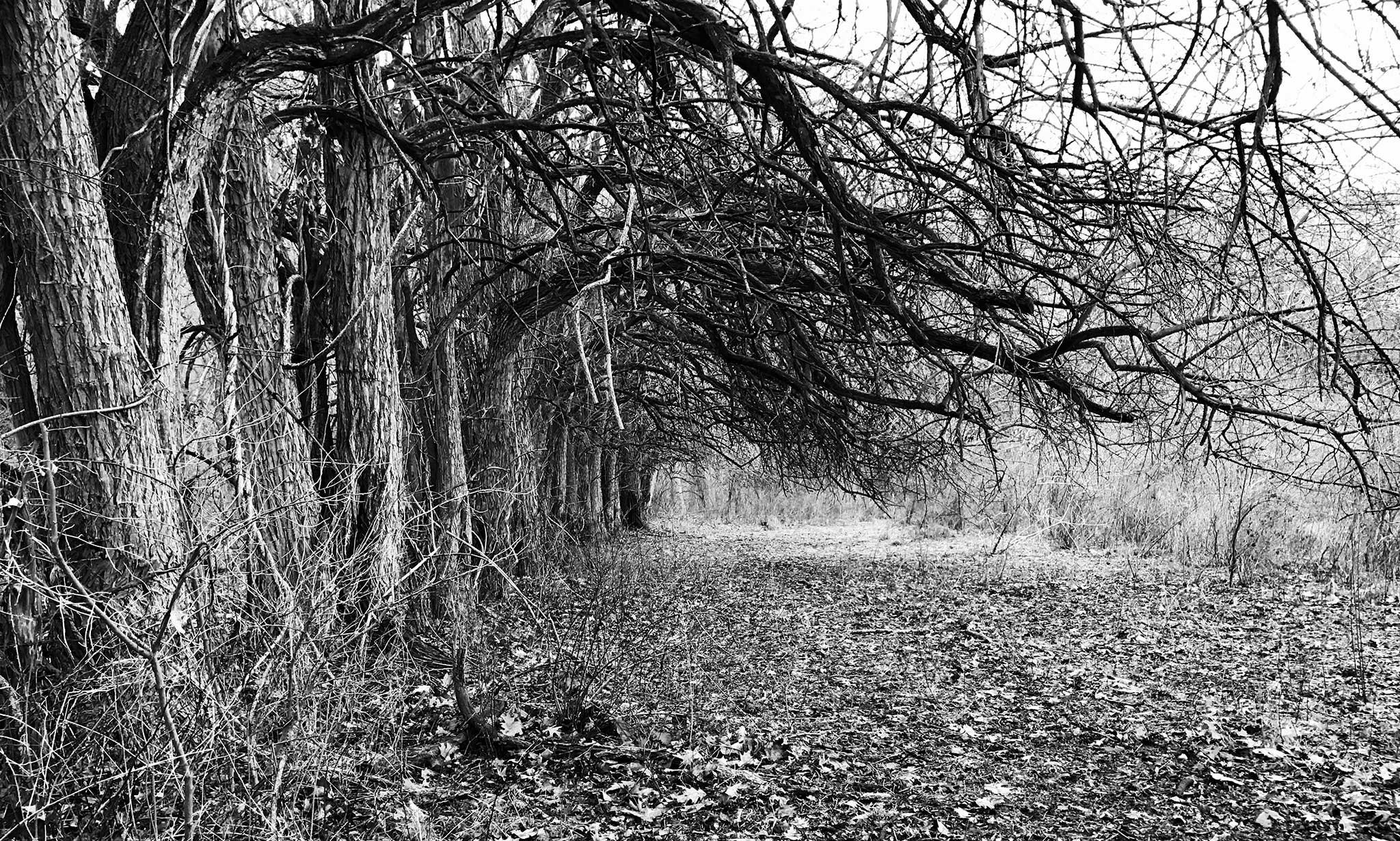
An iPhone photo of some trees lining the edge of an old field, taken one dreary winter morning a year-and-a-half ago while hiking in a local county park with my kids. I hope to get back there in more ideal light with another camera, but I post because I’m also hoping to map this park and its trails.
Many of our local parks have wonderful trails that are poorly mapped, with some lines on a blank white brochure page. With no indicators of trail scenery, terrain, difficulty, or even tree blaze color, it can make choosing a new hike with kids intimidating.
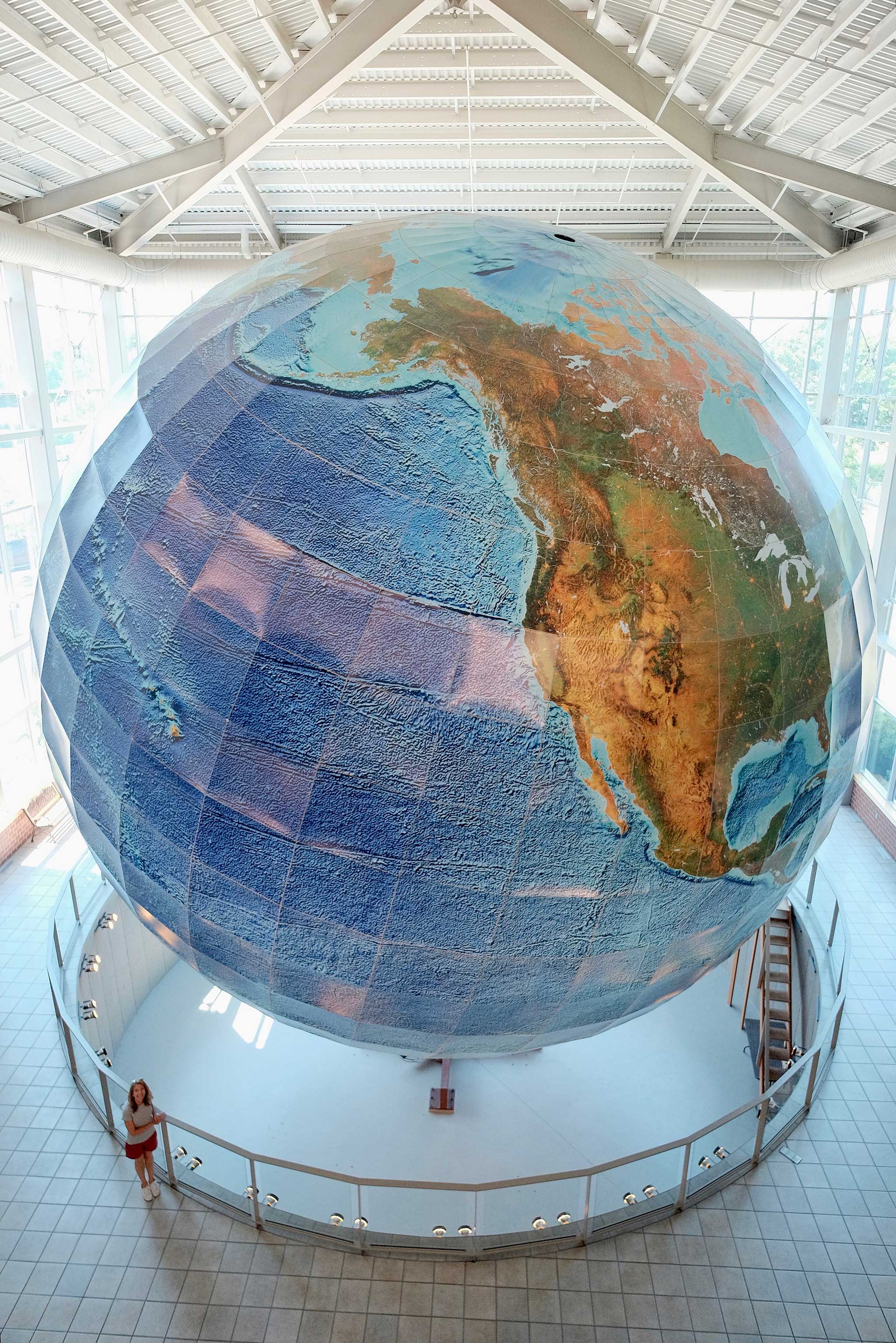
My wife and I took a 10th-anniversary trip (sans kids, thanks Mom & Dad!) to Portland, ME, and while there visited Eartha, the world’s largest rotating globe. Built at Delorme’s (now Garmin) headquarters in Yarmouth, just a few minutes north on I-295 from Portland, the globe is just over 41 feet in diameter and is printed with shaded relief and depth.
We watched from all three stories of viewing platforms for more than a day…but of course a day on Eartha (one full rotation) only takes 18 minutes.
While in Portland we also visited the Osher Map Library on the Portland campus of the University of Southern Maine. I am a lucky guy! The library has an awesome display of rare terrestrial and celestial globes, and many of them have been imaged for 3D viewing online. If you go, ask to see the displays, which are otherwise kept behind curtains to protect the globes from light.